The Needles section of Canyonlands is the area of the park that is south of Colorado River. (The Island in the Sky is north of the Colorado, and east of the Green River.) From Moab, it's about 75 miles (no gas stations, sorry) to the Needles Visitor's Center. This part of the park has very little plumbing -- there is potable water at the campground, and no sewerage (toilets are vault toilets).
I had originally intended to stay at the campground and make a few daytrips, but the campground was full. So I decided instead to go off into the backcountry and camp there. As a result, I probably got to see more than would have under the original plan. (For those keeping score, this was day 75 of my trip, and I was getting tired of travel logistics and being in the desert. This did not prevent me from enjoying what I experienced here in the slightest.)
This section of the park is so named because it houses a variety of hoodoo-like formations. The most attractive portion is an area called Chesler Park. This is basically a desert "meadow" surrounded by these needle-like formations which makes for some really nice pictures.
However, Chesler Park is by no means all there is to see. On my second day in the area, I hiked down to the Druid Arch, which is probably one of the most distinctive formations I saw anywhere in my travels. It's a 4 mile round-trip from the nearest trail junction, and was well worth the effort.
The higher elevations of the Needles made for quite spectacular hiking and views, made more exciting by the fact that there was rain clearly visible to the southwest, and threatening clouds overhead much of the time.
There were several spots where the trail was narrow -- in one place, it was so narrow that my water bottles (carried in the webbed side pockets) acquired memorial scrapes.
Canyonlands marked the end of my time in the desert. From there, I began the long eastward drive home.
Showing posts with label canyonlands. Show all posts
Wednesday, June 04, 2008
Monday, June 02, 2008
Canyonlands National Park: Island in the Sky
To the west of and south of Moab is a vast wilderness of canyons, buttes, mesas, and desert. Much of this area is public land managed by the Bureau of Land Management. The area including the confluence of the Colorado and Green Rivers is contained in Canyonlands National Park.
Due to the nature of the terrain (sheer canyon walls are a fairly common feature), the park is of necessity divided into three sections: Island in the Sky, the Needles, and the Maze.
The Maze is extremely remote and difficult to reach (about 70 miles from the nearest highway to the ranger station, and then more miles over 4WD track). It supposedly lives up to its name: a tangle of canyons and drainages without much in the way of trails, or potable water.
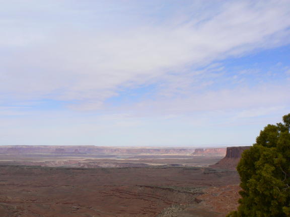
The Island in the Sky is a large mesa that is joined to the rest of the world by a narrow neck, about 50 feet wide. The park literature notes that this neck is eroding, and one day the mesa will indeed become relatively inaccessible. But currently it is possible to drive around the roads on the mesa and see the sights. There are also roads (basically more 4WD tracks) that descend from the mesa onto what is called the White Rim, which is readily visible in some of these photos.
The next post will describe my adventures in the Needles section of the park.
Subscribe to:
Posts (Atom)