Showing posts with label new mexico. Show all posts

Friday, April 18, 2008

The Gila Catwalk

Now that I'm back from my wonderful week in the Grand Canyon, I can continue the story...(the Grand Canyon pictures will come in due course, but there's plenty to tell before then).


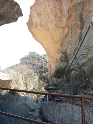
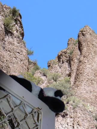
After my trek through the middle of the Gila Wilderness, I headed towards Arizona. However, I took a few hours to visit the Catwalk on the western edge of the Gila. This suspension bridge and suspended walkway are a re-envisioning of access to this narrow canyon, through which mining was done at one time. After mining operations ended, the CCC was called in to turn the area into a recreational opportunity. The suspended walkway and suspension bridge are relatively modern replacements for all of these earlier efforts. The walk up to the top took about an hour, and is ADA-compliant for the lower section.


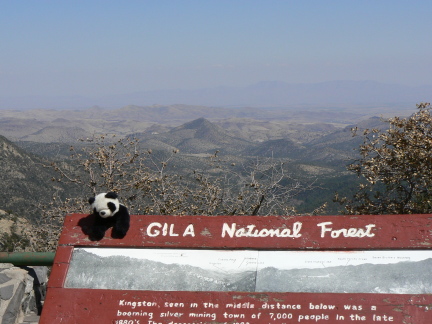
After hiking the catwalk, I stopped for a picnic lunch, and had another lovely view of the Gila before finally heading off into Arizona.

Saturday, April 05, 2008

The Gila Wilderness


I went on a 4-day, roughly 38-mile trek through the Gila Wilderness. The loop provided me with exposure to a variety of terrain and environments that I tremendously enjoyed.

The first day went up Little Creek. This was a wide valley (I won't say canyon, although that's what they call them in these parts), with grassy fields and a mixed ponderosa pine, pinon, and juniper forest. The creek was largely wet, although there were extensive dry patches, including the place where I made camp. The funny thing was, when the wind died down in the evening, I heard running water, and determined that about 150 feet up the trail from my camp there was water. The first night was cold, and it was below freezing by morning (as evidenced by formation of ice crystals in my water bottles).

The second day had the most elevation gain, as it included an ascent of Granite Peak, a roughly 8900-foot mountain. I had to climb about 1000 feet with full pack, up to the spur trail that ascends the peak, and then another 1000 feet up on the spur trail. The upper half of the trail had a fair amount of snow on it, which made for sometimes exciting hiking.

The descent from Granite Peak returned down the spur trail, and then descended into Turkey Creek Canyon (which was much more canyon-like in nature than Little Creek Canyon). The relative steepness of the canyon walls, while not sheer, made finding a camp site a bit of a challenge.

The third day also involved climbing up about 1000 feet to a large plateau. This plateau was beautiful -- it was a vast expanse of ponderosa pine forest, extending for 100s of feet in all directions. It was like walking in a giant natural temple.

The last day was a relatively brief effort, since it involved mostly descent from the plateau back to the car.

All in all, a quite enjoyable experience.

Friday, April 04, 2008

Gila Cliff Dwellings National Monument

[pictures will come later]


From Alamogordo, I went to Albuquerque and flew home (details).


Upon return, I drove south from Albuquerque to Silver City. This is one of the jumping off points for activities in the Gila National Forest. It's called Silver City because the area has lots of mines (including a large open-pit mine about 20 miles east of town), but most of the last 50 or so miles are quite pretty.


In the middle of this National Forest, over a 50-mile road that twists and turns (typical driving time 90-120 minutes), is the Gila Cliff Dwellings National Monument.

This monument was originally proclaimed by Theodore Roosevelt. The cliff dwellings appear to serve some religious and/or political functions, as they are positioned about 2 miles away from the location of a much larger settlement in the Gila River valley. There are a number chambers, some of which were clearly ceremonial/meeting in nature, including a non-round kiva (due to the shape restrictions in the cave, it seems), as well as a small number of chambers that might have been living or storage rooms.

I spent an afternoon there, viewing the ruins, and strategizing for a four-day hike into the Gila Wilderness, which I began the next day.

Before that, I enjoyed a dinner at Shevek & Mi, quite possibly Silver City's nicest restaurant.

Wednesday, April 02, 2008

Alamogordo: White Sands National Monument


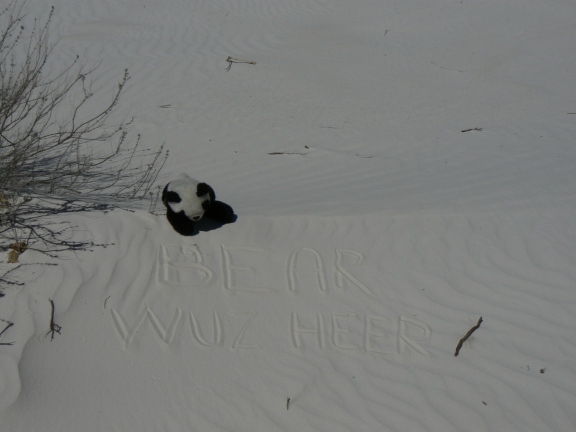
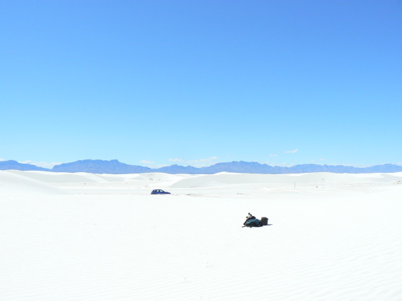
After my adventure in Dog Canyon, and before the interruption, I paid a brief visit to the White Sands National Monument. Some hints of it appeared in the pictures of the previous post. The white sands are pure calcite, formed in a lake bed millions of years ago. As they are exposed by wind and erosion, they get blown east by the prevailing winds, forming these dunes.

Due to logistics, I didn't have the chance to spend the night in the primitive camping available there.

Monday, March 31, 2008

Alamogordo: Dog Canyon


Before the interruption, I was in the area near Alamogordo, New Mexico. I camped at Oliver Lee State Park, in the shadow of the Sacramento Mountains. The park is south of the city, the mountains are to its west. This place was the jumping off point for a hike into Dog Canyon.

The astute will note that I was in a different Dog Canyon earlier this trip.

The night before the hike, I enjoyed a beautiful sunset, and the company of some quail.


The trail wasn't too difficult, and it provided a nice set of views. The total elevation change was about 3000 feet, but I didn't carry a full load to the top. I chose a camp site about 2000 feet up, from which I caught a very interesting view of the White Sands blowing up a storm in the basin below.

After an uneventful night under the stars (I decided to forgo the tent), I returned down to the park.

(Coming soon: accounts of the Gila Wilderness...)

Monday, March 24, 2008

Mostly back on track again

Well, the trip can now get back on track, after a brief visit back east. I'm still having computer problems, so postings will probably be sporadic. Most of the coming week will probably be spent in wilderness areas of the Gila National Forest. With luck, I will post pictures from the Alamogordo and White Sands area before disappearing there.

On a semi-humorous note, Fox "Fair and Balanced" News (nothing about accuracy, there) had a crawl in which the Chinese were blaming Tibetan violence on the Dalai Llama. Where's Oscar Wilde when you need him?

Saturday, March 22, 2008

Carlsbad Caverns: Left Hand Tunnel Tour

The Left Hand Tunnel Tour is a ranger-guided, lantern-lit trek into a lesser-developed area of the main cave. There is no pavement, and no artificial lighting. Participants are given candle-powered lanterns, with the intent of giving a feel reminiscent of what the original explorers would have experienced as they explored the cave for the first time. It's an experience that is different than the more artificial setup in the self-guided Big Room and Natural Entrance sections of the cave, as well as the King's Chamber Tour, which is also artificially lit. As a result, I was unable to take long-exposure no-flash pictures, as I was in the other areas of the cavern. (The difference in how well no-flash pictures capture the actual lighting vs. flash pictures is quite striking. See if you can spot the difference in the previous posts.)

The tunnel is called the Left Hand Tunnel because it goes off to the left from the Natural Entrance.


Carlsbad Caverns: King's Chamber Tour

The King's Chamber Tour is the high point of a visit to the Caverns. It shows the best parts of the cave, which the original explorer, Jim White, gave names referencing royalty.