Showing posts with label big bend. Show all posts

Saturday, March 15, 2008

Canoeing Santa Elena Canyon


After my sojourn at Big Bend Ranch, I returned to Terlingua, and booked a seat on a one-day canoe outing into Santa Elena Canyon with a local outfitter. Normally they prefer to offer rafting trips, which can cover the entire canyon in one day. However, since the Rio Grande's water levels are low, they can only use canoes, and even at that we sometimes scraped bottom...

The outing included three guides and about 20 clients, including a school group from Beeville, Texas. I was paired with one of the guides, a 20-something woman who seemed to like the outdoors as much as I do.

We put in at the lower mouth of the canyon, and then paddled upstream for the morning. We stopped fairly regularly, as (to be expected) the skill levels of the participants varied considerably. I've done some canoeing before.

Eventually we got to a side canyon called Fern Canyon, where we stopped for lunch (essentially a sandwich buffet). After a nice pause, in which some of the kids (and some of their teachers) decided to dive into the river, we headed back downstream, at a slightly faster pace...


Upon return to home base, I immediately took off for Alpine, Texas, where I found refuge at the Holland Hotel, which includes the wonderful Edelweiss Brewery and Restaurant. The beer was good, the veggie burger was pretty much what there was for me to eat.

Thursday, March 06, 2008

The High Chisos, Mount Emory, and the Rim

While at Big Bend, I went on a two-day hike through what is considered some of the best scenery and views available in the park. This is a 16-mile loop, which some people do as a day trip, but is really best experienced as a 2- or 3-day backpack. I opted for a 2-day version.


The trail I took heading up into the mountains is called the Pinnacle Trail. Hmm, I wonder why?


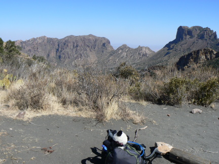
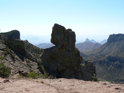
After about 3.5 miles of up, the trail reaches a saddle. Just down a short way from the saddle is the junction with a trail going up Mount Emory, at 7832' the highest peak in the Chisos. This was to me a somewhat interesting summit, as there are three distinct crags to scramble up. I actually went up two of them. All of the sport radio transmission equipment, presumably for park services. (Bear needed to be careful about getting too close to the ledge for some of these pictures -- it was over 100' down from some of them!)


After scaling Mount Emory, I returned to the main trail, which descended into Boot Canyon (covered previously). Along this trail I met a group of young men that had recently seen a mountain lion! It was seen about 1/2 mile from my campsite for the night. While this may sound dangerous, the local mountain lions generally leave humans alone (2 attacks in 20+ years), although they may be attractable to human food, as the black bears in the area can be. All campsites in the mountains had bear boxes for storing "smelly things" -- basically food and any possibly-food-scented things, like soap, were supposed to go there. (This is old hat to people who've camped in bear country before, as I did
just last year.)

The next morning I woke early and headed for around a 4 mile loop that included the much-heralded South Rim, from whence there are wide-ranging vistas to the south, east, and west. You will wonder and the paucity of pictures at this point. When I got there, visibility was about 20 miles -- it was an extremely hazy day, and views of mountains such as the Sierra del Carmen (seen in previous posts) were badly obscured. By contrast (and much to my annoyance), only the next day (when I was out of mountains) there was in fact 100-mile visibility. Ah well.


The hike down was uneventful, with occasional views of The Basin and other features already shown in previous posts.

Tuesday, March 04, 2008

The Basin, The Window, Lost Mine Trail

The Chisos Mountains are the central feature of Big Bend National Park, and there is plenty to see there. Some parts are readily accessible by day hikes lasting 4 hours or less.

The mountain chain was formed by volcanic activity, followed by erosion of surrounding softer limestone. This gave the chain the shape of about a half dozen mountains surrounding a high valley, which is called The Basin. The Basin contains a cluster of services for the park -- lodge with accomodation, store, ranger station, campground, and is accesible by a CCC-construced road. (This means sharp switchbacks and the like.)


One of the most striking features of the Basin is the point at which water drains out of it. This V-shaped cut ends at what is called a "pour" -- this is just a waterfall that is often, or generally, dry. The first picture is a view of the Window from inside the Basin, the second is the view from the desert outside the mountains.


While they were at it, the CCC crew built a trail called the Lost Mine Trail. This is probably the most spectacular day hike in the park.

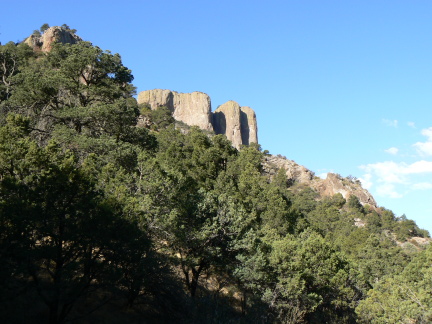
One of the more prominent and spectacular peaks in the mountains is called Casa Grande, and is visible in numerous photos, including these two.


Next update in a few days -- I will be in Big Bend Ranch State Park. (I have more pictures of the national park, so stay tuned for those!)

Monday, March 03, 2008

Big Bend wildlife

Here are a few critters I didn't see while I was in Big Bend:

  • black bears

  • mountain lions

  • snakes

  • scorpions

  • reptiles

  • peregrine falcons


I did speak with a group about 30 minutes after they saw a mountain lion. It was about 1/2 mile from the place I camped in the Chisos Mountains.


Then there were critters that I saw, but did not photograph, often because they're hard to capture on camera.

  • jackrabbits

  • javelina

  • numerous birds

  • golden eagles


The golden eagles were a pair nesting in a tree in the campground I stayed in when I first arrived. I didn't spot them until late the second day.

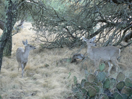
So, I did get a few pictures of wildlife. First, the roadrunner:


The Mexican Jay:


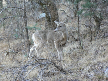
And some deer:


Big Bend's Canyons

Big Bend National Park's natural features basically break down into three areas: desert, mountains, and the Rio Grande. One interesting thing that cuts across all three of these areas is canyons. The river flows through canyons; the desert has (generally) dry canyons; there are canyons in the mountains.


View into Santa Elena CanyonView into Santa Elena CanyonView from Santa Elena Canyon to Big Bend

At either end of the park, the Rio Grande traverses a canyon. Upstream, it is the Santa Elena Canyon, a massive piece of work with 1500-foot-high walls. I hiked into the mouth late one day.


View into Boquillos CanyonSunset view of Sierra del Carmen

Downstream, the river enters Boquillos Canyon. Across the river are the cliffs of the Sierra del Carmen in Mexico. I was serenaded by a Mexican selling trinkets (he on the Mexican side, the trinkets on the US side).


View into Boot Canyon

In the Chisos Mountains, which are the centerpiece of the park, is the beautiful Boot Canyon, which shelters a wide variety of exotic (for the area) life, including ponderosa pine.


View to Dog Canyon
View into Dog Canyon

In the far northwest of the park, I hiked out to two canyons, Dog Canyon and Devil's Cut Canyon. Dog Canyon is the big cut visible in the picture to the left. The trail was basically a straight line across the desert, about 1.2 miles. A (currently dry) wash runs through the canyon, which takes about 10 minutes to walk through, and has walls maybe 2-300 feet high at their highest.


View into Devil's Cut CanyonView at the top of Devil's Cut Canyon

Devil's Cut Canyon is reached by a trail that branches off the trail to Dog Canyon. This trail required some route-finding -- the directions include things like "climb out of the canyon to the right before the walls get too steep", as the bottom of the canyon is not traversible without technical skills. The trail ends at the upper end of the canyon rim, where there is a 300-or-so-foot drop off. (Bear needed to be careful when being photographed -- the breeze might have carried him away...)

On the return from Devil's Cut Canyon to my car, I decided to dead-head across the desert, since I had a pretty good idea where it was (the benefits of a mostly-flat environment, but I had also taken some compass headings before setting out).

Sunday, March 02, 2008

Big Bend desert plants

This is some of the plant life in the desert at Big Bend.


This is a sotol plant:


This is probably a flower from the cactus in the third pic:


This was seen on a canyon floor:


This is one type of yucca (others were also seen...):


I think this is a flower from another type of yucca, but I'm unsure:


Driving to Big Bend

Driving west from Austin, Texas, there were some clear indications of remoteness setting in. These did NOT include driving through places like Fredericksburg , a decent-sized town west of Austin, in the middle of Texas wine country, with, to the mere passerby, an inexplicable amount of German heritage.


Beyond that, things got thin very fast. 80mph speed limits, desert scrub, ranches. I paused in Ozona for lunch, which is the county seat of Crockett County. While a brief web search doesn't turn up any evidence that Davy Crockett was ever there, they do have a statue of him there.


Signs of waning urbanity disappeared somewhere around Marathon, which was (even as I write this) the most recent place my cellphone worked (for placing and receiving calls, you pedants!).
The road south from Marathon was littered with things like this:


The first sign is clearly a warning about water. The second is a flood gauge. I know, this is desert right? (The third picture is taken during the same stop.) The last sign is, well, just a reminder of how far away Big Bend is from everything.


Finally, after 5 days and 2500 miles of driving: