
Sleep on Sunday night was blissfully NOT interrupted by the presence of police at the place I was staying. Several rooms were taken by pipeline workers, and one of them had been, well, drinking. No damage, but the night clerk was none too happy about it, since a number of clients had complained.
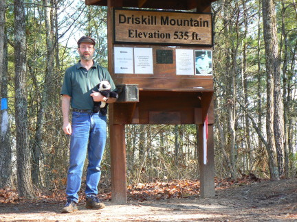
Louisiana's high point, Driskill Mountain is about 15 miles from I-20, roughly midway between Vicksburg and Shreveport. It made a lovely mid-morning break during yesterday's mileage marathon. It was a beautiful day, in the low 60s. The linked description is somewhat out of date -- the trail has received some signage and maintenance from a local scout troop, that make it pretty much impossible to miss. Strangely, almost none of the web resources I found on this place gave a good indication of how long the trail was -- it's roughly 3/4 mile, so it made a diverting walk through the woods. Near the parking area I saw a cardinal (either singing for a date or saying "this is my territory"), and (not photographed) a large raptor, probably an eagle, which was in motion, so I only saw his backside and a fairly impressive wingspan.
Blog entries from now on will be somewhat sporadic -- many of the areas I'm going through are somewhat sparsely populated. Stay tuned for tales and pictures from Big Bend!

No comments:
Post a Comment