Amazingly enough, Arches National Park has things in it that aren't arches, windows, or similar sorts of objects. It's got views, hoodoo-like features, and critters.
These are part of an area called Park Avenue
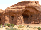
The Courthouse
A moai-like figure.
Balanced Rock
These fin-like formations are where quite a few arches are found.
This area of Arches NP is called the Fiery Furnace. It's a sizable area of fins and hoodoos. Hiking in this area is tightly controlled by the NPS, as there are no trails.
The Dark Angel
A sphinx-like shape near the Delicate Arch
This is a view of the La Sal Range, which is a fixture of the skyline in the Moab area.
Bunny Wabbit!
Smile for the birdie!
Thursday, May 29, 2008
Arches National Park: some arches
There are a lot of natural arches at Arches National Park, just outside Moab, Utah. This should come as no surprise. Here's a sampling of the arches and windows to be seen there. (The beer and food at Moab Brewery are pretty good, and the Moab Diner has a clock that runs backwards.)
Monday, May 26, 2008
Natural Bridges National Monument
North and a ways west of the Valley of the Gods is the Natural Bridges National Monument. This small monument encompasses a few stream drainages containing three fairly impressive sandstone bridges. It's well away from anything -- the nearest town is about 40 miles away, and isn't all that large. It also has a fairly small campground, so if you go in season, arriving late in the day may be problematic if you're expecting to camp. As it was, I snagged the last campsite, leaving a few slowpokes to fend for the alternatives (which, in addition to the long drives to the nearby towns, including primitive camping on BLM lands about 20 miles away).
Views of the bridges are accessed via the traditional driving loop. There are trails that you can take to get to the bases of the bridges, ranging in length from about 1/4 mile to 3/4 mile, as well as trails within the canyons leading from one bridge to the next. Bear and I opted to hike down from each viewpoint to see the bridges from below. We did have some interesting ladders to climb along the way...
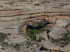
Sipapu Bridge
Kachina Bridge
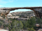
Owachomo Bridge
Sunday, May 25, 2008
Valley of the Gods
The main road heading north from Monument Valley crosses the San Juan River at the tiny town of Mexican Hat (so named for a particular rock formation, what else), and then heads uphill toward the Valley of the Gods, a BLM-managed tract of public land that is similar in character to Monument Valley. It's got a number of formations sticking out of the desert floor, and a (free) 17-mile dirt road to assist in your viewing pleasure.
Before and after the Valley of the Gods, there are stopping points that provide views of the San Juan River. The first is Goosenecks State Park, so named because of the neat gooseneck-shaped river bends. I shot a short movie (63MB download, please be nice).
The second is a place called Muley Point, which is higher up on the mesa. The road leading from the Valley of the Gods up to Muley Point (and further points north) rises about 1000 feet over the course of about 2 miles.
Labels:
2008,
america,
gooseneck state park,
muley point,
road trip,
southwest,
utah,
valley of the gods
Saturday, May 24, 2008
Monument Valley Navajo Tribal Park
Monument Valley is a large area within the Navajo Nation on the Arizona/Utah border. It is famous for its frequent appearance in some famous movies, notably many Westerns directed by John Ford, such as Stagecoach and The Searchers.
The most well-known of the formations are to be found in Monument Valley Navajo Tribal Park, where for a modest fee, you can go on a driving loop that covers most of the highlights. (For larger fees you can go on guided tours that cover areas not otherwise open to the public.)
The most well-known of the formations are to be found in Monument Valley Navajo Tribal Park, where for a modest fee, you can go on a driving loop that covers most of the highlights. (For larger fees you can go on guided tours that cover areas not otherwise open to the public.)
Subscribe to:
Posts (Atom)


