After a quiet evening in Topeka, I headed off into Missouri. My first target was Hannibal, which is best known for being the childhood home of Mark Twain. It's a sleepy town, which, as of this writing, is probably mildly worried about flooding.
The main items of interest to Twain-o-philes are the museum, which includes several buildings having some relevance to Twain, especially as viewed through the lens of The Adventures of Tom Sawyer, and some caves, which would be familiar to readers of that work. I went to the museum but not the caves, and enjoyed strolling around the small riverfront area.
I spent the night at Mark Twain State Park, which is on Mark Twain Lake, right near the hamlet of Florida, which is where Samuel Clemens was born. The house he was born in is preserved in a chapel-like museum in the park.
From there I drove down to Saint Louis, where the extent of my sightseeing was a visit to the Jefferson National Expansion Memorial, best known for being home to the Gateway Arch.
OK, a bit touristy, but I needed a break before driving on to Kentucky.
Thursday, June 19, 2008
Tuesday, June 10, 2008
Denver, and heading east
The main road from Black Canyon to Denver is US-50. It goes over Monarch Pass, and in early May, it was snowing at the top. Further along the road I stopped in Fairplay, home of Two-Mile High Stadium, and apparently inspiration for South Park (not that I'm a big fan of that show).
This was my first visit to Denver, a place whose airport I've seen quite a few times. I didn't spend a grand amount of time there, since I arrived late in the day. The next day was spent at the Denver Art Museum, absorbing the new modern wing and an interesting special exhibit on artistic influences on the Impressionists.
After Denver, I headed east across the plains. The race east was only interrupted by a brief 30-mile detour to the highest point in Kansas. (It's a bump in the prairie called Mount Sunflower...)
Dinner and rest were in Topeka, Kansas, since that's where I got tired.
Thursday, June 05, 2008
Black Canyon of the Gunnison National Park
It's a long road from eastern Utah back home.
I didn't follow that route. I aimed for a pretty spot in the middle of the Colorado Rockies, Black Canyon of the Gunnison National Park. (Yet another place I never heard of until I started looking at driving routes.)
The canyon is sightworthy because it is one of the deepest and narrowest canyons in North America. The walls of the canyon are very hard pre-Cambrian rocks -- the same kind of stuff found at the bottom of the Grand Canyon. The canyon is over 2000 feet deep at some points.
I spent a cold and rainy night (the rain being something of a novelty after all those days in the desert) there before continuing on to Denver.
Wednesday, June 04, 2008
Canyonlands National Park: The Needles
The Needles section of Canyonlands is the area of the park that is south of Colorado River. (The Island in the Sky is north of the Colorado, and east of the Green River.) From Moab, it's about 75 miles (no gas stations, sorry) to the Needles Visitor's Center. This part of the park has very little plumbing -- there is potable water at the campground, and no sewerage (toilets are vault toilets).
I had originally intended to stay at the campground and make a few daytrips, but the campground was full. So I decided instead to go off into the backcountry and camp there. As a result, I probably got to see more than would have under the original plan. (For those keeping score, this was day 75 of my trip, and I was getting tired of travel logistics and being in the desert. This did not prevent me from enjoying what I experienced here in the slightest.)
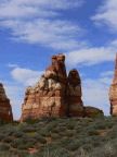
This section of the park is so named because it houses a variety of hoodoo-like formations. The most attractive portion is an area called Chesler Park. This is basically a desert "meadow" surrounded by these needle-like formations which makes for some really nice pictures.
However, Chesler Park is by no means all there is to see. On my second day in the area, I hiked down to the Druid Arch, which is probably one of the most distinctive formations I saw anywhere in my travels. It's a 4 mile round-trip from the nearest trail junction, and was well worth the effort.
The higher elevations of the Needles made for quite spectacular hiking and views, made more exciting by the fact that there was rain clearly visible to the southwest, and threatening clouds overhead much of the time.
There were several spots where the trail was narrow -- in one place, it was so narrow that my water bottles (carried in the webbed side pockets) acquired memorial scrapes.
Canyonlands marked the end of my time in the desert. From there, I began the long eastward drive home.
Monday, June 02, 2008
Canyonlands National Park: Island in the Sky
To the west of and south of Moab is a vast wilderness of canyons, buttes, mesas, and desert. Much of this area is public land managed by the Bureau of Land Management. The area including the confluence of the Colorado and Green Rivers is contained in Canyonlands National Park.
Due to the nature of the terrain (sheer canyon walls are a fairly common feature), the park is of necessity divided into three sections: Island in the Sky, the Needles, and the Maze.
The Maze is extremely remote and difficult to reach (about 70 miles from the nearest highway to the ranger station, and then more miles over 4WD track). It supposedly lives up to its name: a tangle of canyons and drainages without much in the way of trails, or potable water.
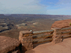
The Island in the Sky is a large mesa that is joined to the rest of the world by a narrow neck, about 50 feet wide. The park literature notes that this neck is eroding, and one day the mesa will indeed become relatively inaccessible. But currently it is possible to drive around the roads on the mesa and see the sights. There are also roads (basically more 4WD tracks) that descend from the mesa onto what is called the White Rim, which is readily visible in some of these photos.
The next post will describe my adventures in the Needles section of the park.
Subscribe to:
Comments (Atom)


