Showing posts with label summer. Show all posts

Thursday, November 05, 2009

New York to Toronto

August 15, 2009


Crown Point lighthouse

Following about a week at home, I again set out. Herself and I had planned several days in Toronto; the plan was that I would drive and she would fly. I left on August 15, and drove to Crown Point, New York, only 15 miles or so from Ticonderoga, where I was recently.

Besides being on beautiful Lake Champlain, Crown Point is the site of more colonial history. It is the site of two ruined forts: Fort St. Frédéric, constructed by the French in the 1730s, and Fort Crown Point, built by the British in 1759, late in the French and Indian War. Neither fort was ever attacked militarily; both forts were largely destroyed by defenders before withdrawing from them before superior forces, although buildings in Fort Crown Point were destroyed by fire in 1773. The remains of both forts are now part of a New York state historical site, and there is an attached campground, where I spent the night. The area's first European explorer was Samuel de Champlain, who modestly named the lake for himself. On the tercentenary of his exploration, a lighthouse was erected at Crown Point to mark the occasion. It features a sculpture depicting Champlain and his native (probably Huron) guide, as well as a small bronze by Auguste Rodin, representing France.

The following day was spent in a somewhat leisurely drive across the center of the Adirondack Mountains to Watertown, and then north to Cape Vincent, where Horne's ferry took me to the Canadian Wolfe Island, and another took me to Kingston, Ontario. A drive along the Loyalist Highway (so named because the area was settled during and after the Revolution by colonists Loyal to the Crown) brought me to Carrying Place, Ontario, where I pitched my tent in a commercial campground otherwise full of RVs semi-permanently ensconced in their lots.

On the morning of August 17, I drove to the Toronto airport and picked Herself up, after which we made our way to the hotel in the city.

Sunday, November 01, 2009

Vermont: High peaks of the Green Mountains

August 8, 2009


The next morning, after visiting Mount Defiance on the New York side, I crossed over Lake Champlain into Vermont at the Ticonderoga ferry (which has recently been overwhelmed by traffic due to the closure of the Lake Champlain Bridge at Crown Point). From there I drove to the Mount Independence State Historic Site, where I went for a lovely hike through the woods, reading the occasional interpretive sign about the military uses and history of the archaeology of the area. I then drove on to the Hubbardton Battlefield State Historic Site, continuing the theme of Revolutionary War history.

From there, after pausing in Middlebury, Vermont for lunch and a stroll through the farmer's market, I made my way back into the Green Mountains and Lincoln Gap, where I left the car and took to my feet for an overnight backpack.

The portion of the Long Trail I embarked on is known as the Monroe Skyline, after one of the prime movers behind the establishment of the Long Trail. There are two peaks over 4,000 feet on this section, and Mount Abraham was about 3 miles from the gap. Even though it is just over 4,000 feet, it has a bare summit with 360-degree views, including spectacular views of Lake Champlain to the west. After stopping at the summit for a rest, I hiked about 10 minutes further along the trail, and located a suitable spot off the trail to pitch my tent. After an early dinner I climbed back to the summit to observe the sunset.

August 9, 2009


Leaving most of my gear near my campsite, I got an early start, and hiked further along the ridge until I reached the summit of Mount Ellen. There are a number of intervening peaks that are only modest bumps above the ridgeline, and the upper ends of ski lifts punctuate the ridge and provide opportunities for views. Shortly after heading on my way back from Mount Ellen, the sky began to cloud over; by the time I recovered my gear and got back to the top of Mount Abraham, the view had noticeably disappeared...

I returned to my car by early afternoon, and headed off for Waterbury, Vermont, where I made myself comfortable at the campground of the Little River State Park.

August 10, 2009


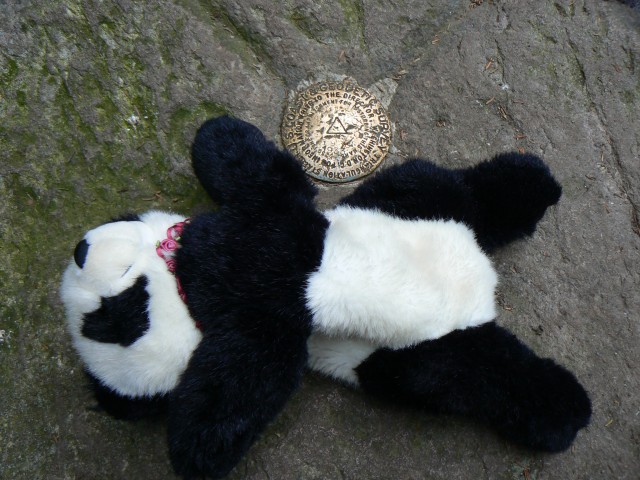
My plan for this day was to enjoy a climb of Vermont's second-highest peak, Camel's Hump. While I succeeded in climbing it, the weather was difficult, and the higher reaches were entirely socked in with clouds and subjected to period rain. This put a definite damper in Bear's desire to take pictures, and made the mountain's supposedly great views less than stellar.

The weather was somewhat better down in the valley. I took a leisurely drive south until I reached Killington, where I set up camp at Gifford Woods State Park, and dried out my gear.

August 11, 2009


While I had originally contemplated attacking Mount Killington, the day hike seemed a bit long to me, and it was necessary for me to return home, so I abandoned that idea and made tracks for home.

Wednesday, October 28, 2009

New York: Saratoga and Ticonderoga

August 7, 2009


Having lately cultivated an interest in early American history, I decided to visit Saratoga National Historical Park and Fort Ticonderoga, scenes of colonial and Revolutionary War events.

Saratoga was the scene of a pivotal series of battles in 1777 that resulted in the formal entry of France into the American Revolutionary War (it had already been "covertly" supporting the independence movement). While the Americans had management issues in the defending army, they were able to raise both army and militia forces to defeat a British army coming from Quebec. (Pictured at right: Philip Schuyler, who led the army until August 1777, Horatio Gates, who led during the key battles, and Daniel Morgan, whose men played an important role. Not pictured, since there is no statue, is Benedict Arnold, whose valor at Saratoga on behalf of the Americans was overshadowed by his treacherous change of sides in 1780. Arnold is commemorated at Saratoga by the Boot Monument, which honors his left leg, which was severely injured in the second battle.) The national park encompasses the battlefield and the location about 10 miles to the north where John Burgoyne's army eventually surrendered. While I enjoyed a beautiful morning exploring the area, I personally find historic battlefield photos unininspiring, hence none here...

From Saratoga it's a drive north along the Hudson to Glens Falls, and then along Lake George to the small town of Ticonderoga. While portions of the NY Route 9N are scenic, the views along the southern reaches of the lake are constrained by somewhat intensive resort buildup. The fort is best known for being the scene of action both during the Revolution and the French and Indian War, when a large, incompetently-led British army was defeated by a French defense about 25% of its size. Due to strategic issues with the fort's location (it is overlooked by hills where cannons can easily be placed to fire into it), the fort itself was never actually directly attacked either in that battle, or during the 1777 campaign, when the defending Americans withdrew to avoid being surrounded and captured.

Following an afternoon at Fort Ticonderoga, which included a demonstration of musket and cannon fire, I camped at the nearby Rogers Rock Campground.

Thursday, October 22, 2009

Vermont: Bennington, Stratton Mountain

August 5, 2009


This day began a six-day trip through southern Vermont and adjacent portions of New York State. My goals were two-fold: first, to explore the greener parts of Vermont, and second, to visit a few historically interesting American Revolutionary War sites.

My first goal after departing the home turf was the southern Green Mountains, where I planned to camp on the first night. I drove a leisurely route to Bennington, Vermont, where I had a nice lunch at the Madison Brewery Company.

Unbeknownst to me until I got there, Bennington was in the middle of celebrating Moosefest, marked by placing colorfully-decorated fiberglass moose around town. I did not seek all of them out, but a few caught Bear's interest.

Eventually we escaped the clutches of the moose-infested town and made our way into the mountains, where I occupied one of the road-side campsites on the Kelly Stand Road. This now-depopulated area was once the site of a speech by Daniel Webster attended by 15,000 people.

August 6, 2009


After an uneventful night, I made my way to the local trailhead for the Long Trail and headed north to the summit of Stratton Mountain (which is probably best known for having a ski area on it. It was a beautiful day, and the summit tower had stupendous views in all directions. I also chatted with other hikers, some of whom were through-hiking either the Long Trail or the Appalachian Trail. One of them was kind enough to leave us with a few photos.

As the hike to the summit was not an overly difficult one, I returned to the car by early afternoon, and headed west. Crossing into New York, I checked into a commercial campground on the Batten Kill River for the night.

Friday, August 10, 2007

A day in Asheville

Thursday June 28

[Sorry about the delay in the trip details. Moving interfered, but photos are now up in the earlier trip entries.]

This day was a rest day to recover from the previous 4 days of hiking. A lazy day was spent, including a slow stroll through Asheville to photograph some of its architectural variety.


First up, this is the courthouse.


I think this is/was a bank building.


Interesting detail on local retail/commercial building.


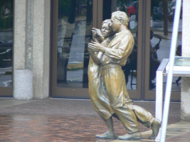
Outside the convention center are these statues capturing local music and dance tradition.


Dinner was at Limones in Asheville, and featured quite possibly the smoothest chocolate mousse I've ever had. Yum.

Monday, July 09, 2007

Clingman's Dome

Sunday June 24 to Wednesday June 27

On a fine warm North Carolina morning I set out to climb Clingman's Dome. Here are a few factoids about it, before we get started:

  • It's the highest point on the Appalachian Trail.

  • It's the highest point in the state of Tennessee.

  • Its summit observation tower is pretty close to ADA-accessible. Wheelchairs and stroller will make it, but not without assistance (the steep grade, mostly)

  • It's a great place to see the Smoky Mountains

  • Other than the access road, it's probably a 20-mile round trip (and at least 3-4000 feet of elevation) to the summit.


The National Park authorities require (free) permits before going into the backcountry. This is probably a Good Thing, since they know where to look for you. Camping in the backcountry is free, and restricted to campsites, most of which are fairly basic -- fire grates, food-hanging cables (to bearproof your site), some nearby water, and flat ground for your tent. The food-hanging cables were a new contraption to me, but easy to use.

Day 1 started with a brief 2+ hour hike (with full pack, thank you), to camp 74, which is near to Fontana Lake. After establishing camp, I spent the afternoon alternating between swimming in the lake (which was about 2-3 feet below "normal", and thus not that attractive, and fully exposed to summer sun), and relaxing in camp (shaded, moderately cool, but buggy).

Some of the trails in the park are open to horse-riding. This would be a recurring "feature" of the trail -- avoiding the horse droppings.

Day 2 was the first half of the Big Push: climb up about 2500' with a full pack, over a distance of about 8 miles. This was accomplished in about 6 1/2 hours, made exciting by a significant number of stream crossings (all manageable, but some were a fair amount of work when carrying a full load), and one ornery rattlesnake. The day ended at camp 68, where camp was erected in near-record time to be ready before rain arrived.

Day 3 was the second half of the Big Push: climb another 2500' with a day bag, an 8 mile round trip, plus another 2-3 miles of downhill under load to camp 69. The summit was a typical tourist-infested summit, but the views that day were quite nice (probably due to the rains of the day before).

Day 4 was the return to civilization -- about 8 miles of mostly downhill, but a spurt of up-and-down at the very end that is usually annoying because the muscles are all saying "we like going down, thank you".

After 3 1/2 days of not showering, hotel rooms are mighty nice.

Dinner was at Mela, a fine Indian restaurant in Asheville. I had quite possibly the best (certainly the freshest) Shahi Paneer I've ever had.

Happy trails!

Thursday, June 28, 2007

Sassafras Mountain and Hendersonville

Saturday June 23

Today was divided between preparing for tomorrows departure into the Smokies, and a drive to the south of Asheville. The first destination, which was really more of an excuse for a country drive (besides being South Carolina's highest point), was Sassafras Mountain, South Carolina. Read the link, it's a decent description of what to expect. (My consolation is that I already knew what the view from there would be like.)

I also stopped in Hendersonville, NC, especially since I spotted some ice cream on a hot day. It also happens to be a place my parents occasionally visit, since it has a change ringing setup in one of its church towers.

Dinner was provided by an uninspired waitress at a largish Mexican restaurant. The food was filling and cheap, but also uninspired.

Saturday, June 23, 2007

Asheville and Mount Mitchell

Thursday June 21

This day was partly a logistics day. Some necessary shopping, some supplies for at least tomorrow's assault on Mount Mitchell. I also visited the Folk Arts Center, which has nice displays and sales of contemporary regional folk arts, and a cool display on the design and construction of the Blue Ridge Parkway, going into some detail on the design principles that make the road as attractive as it is. I then drove on to Black Mountain, a small town outside Asheville with a one-street walkable downtown. Good for lunch, a haircut, and the necessary purchase of cooking gas for the upcoming trek into the Smokies.

Dinner was at the Laughing Seed Cafe, a place definitely Russell-unfriendly. Which means I liked it.

Friday June 22

This morning featured a hike up the highest mountain east of the Mississippi. Mount Mitchell is, amazingly enough, not on the Appalachian Trail, but it has lovely views out to the Smokies. Unfortunately, the very top of the summit was closed off due to the reconstruction of the observation platform.

Did I mention there was a road up to the summit area, and a concession stand? I actually hiked from further down, near where the access road meets the Blue Ridge Parkway. The trail featured some nice (if slightly after-peak) rhododendrons.

Dinner was at the Ophelia's World Cafe. It was good, but I really liked the other places I've eaten better.

Next update will not be until probably next Thursday, due to four-day hike into the Smokies.

Happy Trails!

Thursday, June 21, 2007

The beautiful Blue Ridge

Monday, June 18


Today I drove down a stretch of the Blue Ridge Parkway. This scenic road stretches from Northern Virginia to southwestern North Carolina. Today I drove about 100 miles, taking about 4 hours, including stops to enjoy views and such along the way. I made my way west along an extremely windy stretch of US 58 to Virginia's Grayson Highlands State Park.This gem of a park contains some nice open highlands, has facilities for camping and horseriding, and is also along the Appalachian Trail. I stayed in the campground for the night, but not before enjoying a spectacular sunset view from a point called (imaginatively enough) Little Pinnacle. Along the way I spotted rabbits and deer.

The park is adjacent to the Mount Rogers National Recreation Area, where I spent some time the next day.

Tuesday, June 19

This morning featured a bright and early start. Since a chance of thunderstorms was forecast for this afternoon, I thought it wise to tackle Mount Rogers early today. I actually managed to break camp and be at the trailhead by 7:15. I know, not impressive, unless you know how much I like getting up some mornings.


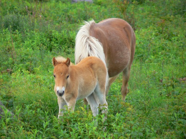
The hike to Mount Rogers (5729 feet, highest point in Virginia) was about 8 miles round trip, with about 1000 feet of elevation gained. Parts of the route are on the AT. The landscape was fairly open, often with views mostly in southerly directions. The primary large inhabitants of the area seem to be wild ponies, some of which were not shy at all. (At least they're not as dangerous as bear, which are also a presence along much of the Appalachians.) The summit of Rogers is wooded, but the whole rest of the hike was very pleasant.
The weather was overcast with pockets of sun and drizzle. I returned to my car around 11:30.

From Grayson Highlands, I drove further down the very twisty US 58 to Abingdon, VA, where I picked up I-81 and made my way on to Asheville, NC. After ensconcing in my hotel on the outer edge of town (and also napping), I headed downtown for dinner and ice cream. I find that Marble Slab serves pretty nice ice cream.

Wednesday, June 20

My first full day in the Asheville area, and time to do some research. I'm interested in hiking Mount Mitchell (highest point in the eastern US) and Clingman's Dome (scenic high point in the Smoky Mountains). I decide to drive more of the Blue Ridge Parkway toward the main NC entrance to Great Smoky Mountain National Park, to acquire maps and information about permitting. Along the way, I stop to summit Mount Pisgah (not to be confused with a church or a similarly named peak in Pennsylvania.) This was a short hike, 3 miles RT and 700 feet up to the summit. I met a middle-aged couple and his father, who had originally been on the summit 40 years before. They had interesting insights into the changes in the summit area (which features a TV transmission tower among other things).

Lunch was a southern affair at The Tupelo Honey Cafe. Toasted tomato and cheese sandwich with a side of fried okra. Yum.

Dinner was also a local affair, at the Early Girl Eatery. Once again Yum, but not much Russell-friendly here.