Wednesday, April 30, 2008
Grand Canyon: Down to the river
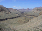
The Tonto trail runs east-west, roughly paralleling the Colorado River. However, it also tries to maintain a somewhat consistent altitude, which leads to some extra work when side canyons are encountered. Because these side drainages are sometimes fairly large in their own right, traversing around them at a more-or-less-constant altitude is an exercise in zig-zagging around the side canyon (and its side canyons). It can easily take over two hours to traverse a side drainage, covering about 1/4 mile of Colorado River length. This is part of the fun of hiking the GC.
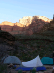
Most of our camps, including the first one, were located at the back of one of these side drainages, generally because this is where water is to be found.
Oh, I haven't discussed water yet. The lower reaches of the Grand Canyon are desert. The weather forecasts for the canyon bottom are similar to those for Phoenix (in marked contrast to the forecast for the rims, which are forested and cooler). As in all deserts, water is very important, and knowing where to find water in your area is important. In a place like the GC, water of good quality is generally found in the side drainages, so, especially for large groups like ours, these are the places we camp. (The water from the Colorado River is generally quite silty, and does not make the best drinking water for this reason. The streams in the side drainages are clear, assuming they're running.)
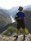
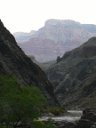
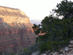
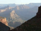
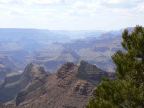
The series of pictures to the left starts with the trek along the Tonto to our first camp, and then the second day's trek along the Tonto and then down to the river, where we had our second camp.
Grand Canyon: Hiking down
The day before the hike, the group met for the first time, mainly for briefing and to distribute the "commissary", or shared load. The commissary consisted of pillow cases containing about 10 pounds each of food, kitchen tools, cooking fuel, and so on. Each person in the group carried one, which, fortunately for us, got lighter as the trek progressed.
The morning of the beginning of our trek, we met at the (to me) ungodly hour of 4:45, to catch a 5:00 shuttle bus to our trailhead. The westernmost point accessible from the South Rim Grand Canyon Village is a place called Hermit's Rest, and this is where we began our trek. The pictures at left are a basically chronological sequence of the descent into the canyon.
The widely-seen parts of the Grand Canyon have a somewhat straightforward structure. The Colorado River is cutting a gorge down the middle of the canyon, through an extremely hard layer of volcanic schist. About 1000 feet above this is a relatively broad area where sedimentary layers predominate. This occurs because the sediments erode by wind, water, and flash flooding faster than the schist layer. It is at this layer that the Tonto trail roughly parallels the canyon. Most treks through the canyon consist of a hike down from the rim to the Tonto, traversing along the Tonto, and then returning to the rim, likely in a different place. There may be trips down to the river along one of the side canyons.
In this trip, we descended the Hermit Trail to the Tonto, and then traversed west for 6 days. (For those paying close attention, this means we traveled away from the widely-seen portions of the canyon that are visible from the south rim.) On two occasions we descended to the river, once to camp, and once (on the last day in the canyon) to have a "day off".
Tuesday, April 29, 2008
From Flagstaff to the Grand Canyon
I had a day in Flagstaff to deal with final logistics before heading up to the Grand Canyon. I took part of that day to visit the Museum of Northern Arizona, another showcase of local history and archaeology (not to mention a gallery of Grand Canyon art).
My drive up to the Grand Canyon from Flagstaff had a side-trip. I chose to take the slightly longer eastern route, which conveniently passed by two National Monuments.
 Sunset Crater National Monument covers an area that was volcanically active as recently as 1000 years ago. This area is immediately east of the San Francisco peaks, which are the remnants of a giant volcano. There is ample archaeological evidence from the time around 1100AD that local residents were affected by the eruptions in this area. The lava flow pictured at left dates from that time.
On the same side loop as the Sunset Crater NM is the Wupatki National Monument. This is a collection of ancient dwellings that appear to have been abandoned around the time of the Sunset Crater eruptions. Many of them were preserved by CCC action in the 1930s. Those pictured (and quite a few more that are not accessible to the public) are on a loop off the main road heading from Flagstaff toward Page, AZ.
Well before reaching Page, the Navajo community of Cameron is the turning point for heading west toward the Grand Canyon. The road passes to the south of the canyons formed by the Little Colorado River, a tributary of the Colorado. I stopped along the way to see some of these canyons, and got to experience a helicopter flying inside the canyon (something not permitted in Grand Canyon National Park).
 Finally!
En route to the Grand Canyon Village, I stopped at a few pullouts...
My drive up to the Grand Canyon from Flagstaff had a side-trip. I chose to take the slightly longer eastern route, which conveniently passed by two National Monuments.
 Sunset Crater National Monument covers an area that was volcanically active as recently as 1000 years ago. This area is immediately east of the San Francisco peaks, which are the remnants of a giant volcano. There is ample archaeological evidence from the time around 1100AD that local residents were affected by the eruptions in this area. The lava flow pictured at left dates from that time.
On the same side loop as the Sunset Crater NM is the Wupatki National Monument. This is a collection of ancient dwellings that appear to have been abandoned around the time of the Sunset Crater eruptions. Many of them were preserved by CCC action in the 1930s. Those pictured (and quite a few more that are not accessible to the public) are on a loop off the main road heading from Flagstaff toward Page, AZ.
Well before reaching Page, the Navajo community of Cameron is the turning point for heading west toward the Grand Canyon. The road passes to the south of the canyons formed by the Little Colorado River, a tributary of the Colorado. I stopped along the way to see some of these canyons, and got to experience a helicopter flying inside the canyon (something not permitted in Grand Canyon National Park).
 Finally!
En route to the Grand Canyon Village, I stopped at a few pullouts...
Saturday, April 26, 2008
Oh, some more desert stuff
Considering I'm about 3 weeks behind in the story, it's surprising I still manage to leave something out. Note to self: check the picture folder before posting for pictures that might precede what I'm righting about.
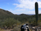
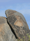
Alongside the Desert Museum outside Tucson is one arm of the Saguaro National Park. (The other branch is on the east side of Tucson.) After visiting the Desert Museum, I spent the remainder of the afternoon amongst the desert giants, the Saguaro Cactus. There was also a petroglyph site with extensive rock art.
This, of course, occurred before the events described in the previous post...
Coming up Real Soon Now, Grand Canyon pictures, to be followed by pictures from Zion, Bryce, and wherever I happen to land next. :-)
Subscribe to:
Comments (Atom)

