Wednesday, April 30, 2008
Grand Canyon: Down to the river
The Tonto trail runs east-west, roughly paralleling the Colorado River. However, it also tries to maintain a somewhat consistent altitude, which leads to some extra work when side canyons are encountered. Because these side drainages are sometimes fairly large in their own right, traversing around them at a more-or-less-constant altitude is an exercise in zig-zagging around the side canyon (and its side canyons). It can easily take over two hours to traverse a side drainage, covering about 1/4 mile of Colorado River length. This is part of the fun of hiking the GC.
Most of our camps, including the first one, were located at the back of one of these side drainages, generally because this is where water is to be found.
Oh, I haven't discussed water yet. The lower reaches of the Grand Canyon are desert. The weather forecasts for the canyon bottom are similar to those for Phoenix (in marked contrast to the forecast for the rims, which are forested and cooler). As in all deserts, water is very important, and knowing where to find water in your area is important. In a place like the GC, water of good quality is generally found in the side drainages, so, especially for large groups like ours, these are the places we camp. (The water from the Colorado River is generally quite silty, and does not make the best drinking water for this reason. The streams in the side drainages are clear, assuming they're running.)
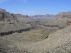
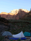
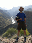
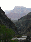
The series of pictures to the left starts with the trek along the Tonto to our first camp, and then the second day's trek along the Tonto and then down to the river, where we had our second camp.
Subscribe to:
Post Comments (Atom)


No comments:
Post a Comment